Introduction to Mount McKinley and the Gulf of Mexico
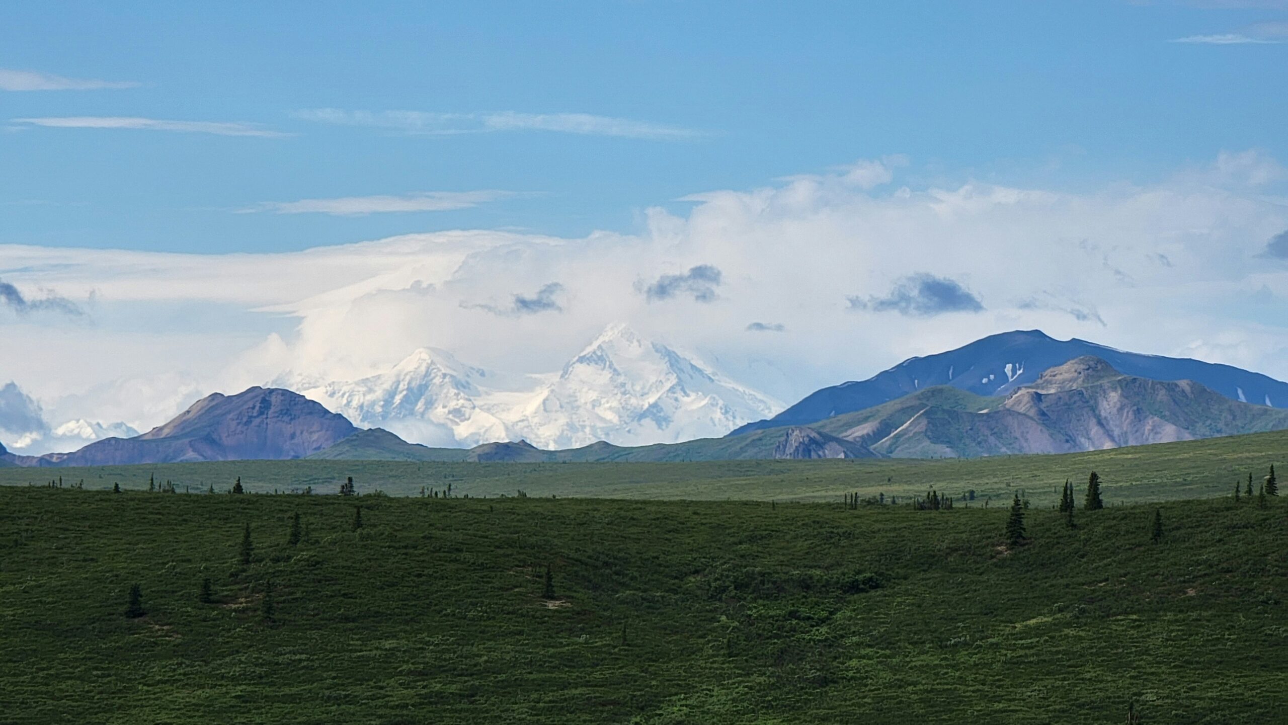
Mount McKinley, recently renamed Denali, represents the highest peak in North America, reaching an elevation of 20,310 feet above sea level. Located in Alaska’s Denali National Park and Preserve, this majestic mountain not only holds significance due to its height but also as a vital part of the American landscape. Denali is revered by many Indigenous cultures, symbolizing strength and endurance, while simultaneously attracting climbers and nature enthusiasts from across the globe. Its prominence shapes both the natural environment and the cultural identity of the region.
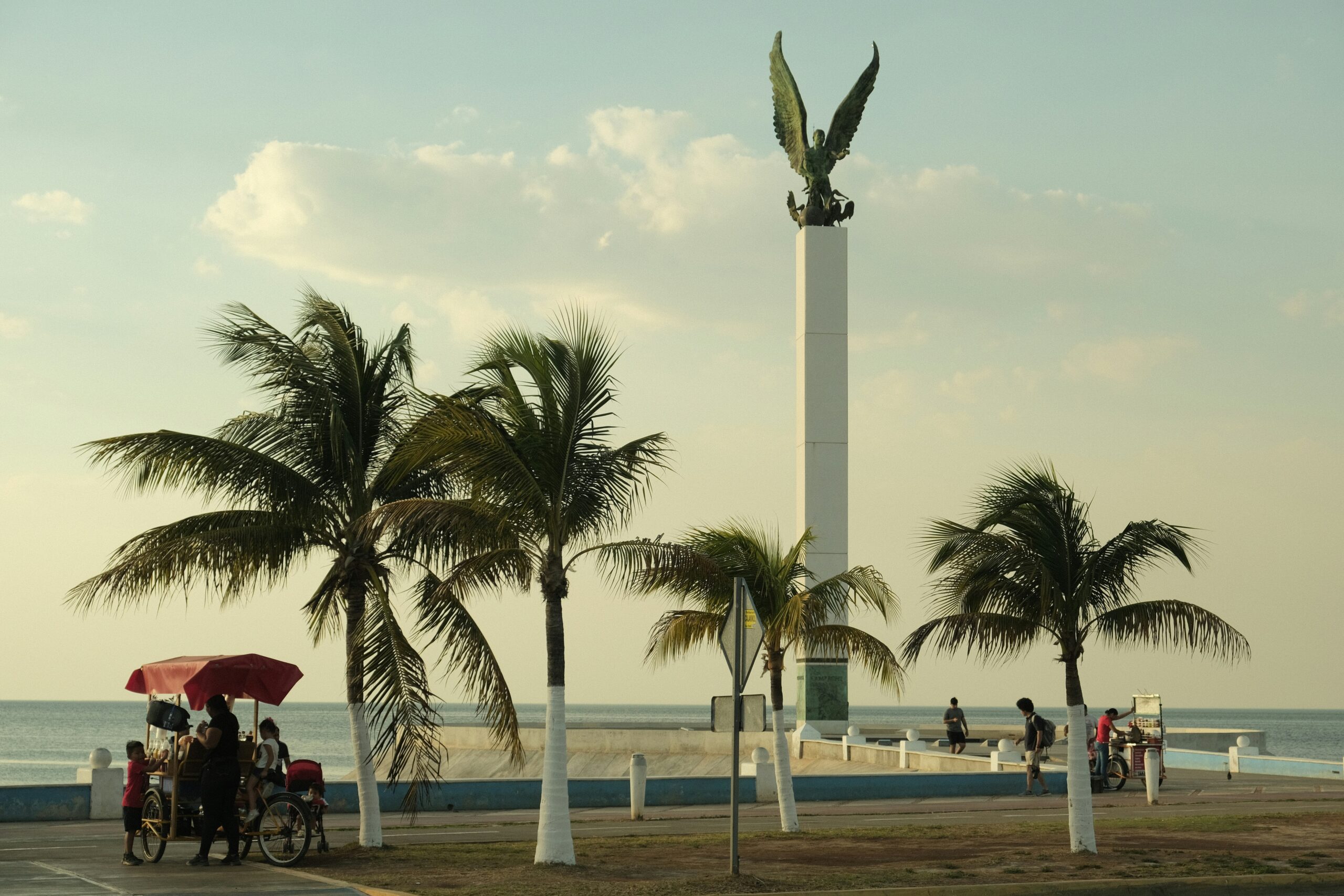
The Gulf of Mexico, an expansive water body bordered by the southeastern United States, Mexico, and Cuba, plays a crucial role in the maritime geography of North America. Covering approximately 600,000 square miles, it serves as a significant shipping route and a crucial hub for trade. The Gulf is not only vital for its economic contributions but also for its environmental richness, hosting diverse ecosystems such as marshlands, bays, and coral reefs. The warm waters of the Gulf often influence weather patterns, making it an essential factor in the region’s climate.
Both Mount McKinley and the Gulf of Mexico have profound implications in terms of history and politics. Mount McKinley’s peak has been emblematic of challenges and triumphs in exploration and mountaineering, encapsulating the spirit of adventure and human determination. On the other hand, the Gulf of Mexico has been the stage for significant historical events, including colonial expansion, conflict, and economic development, shaping the geopolitical landscape of the surrounding areas. Together, these two geographic entities symbolize the rich tapestry of the American experience, bridging the natural world with cultural and historical narratives.
The History Behind Mount McKinley and its Name Changes
Mount McKinley, known as Denali by the indigenous peoples, is a prominent peak within the Alaska Range, renowned for its majestic elevation, standing at 20,310 feet. The mountain’s historical significance cannot be overstated, encompassing rich cultural narratives and a contentious political legacy. Originally referred to as Denali, which translates to “The High One” in the Athabascan language, the mountain symbolized the identity and heritage of native tribes long before European exploration.
In 1896, the mountain was renamed Mount McKinley in honor of then-presidential candidate William McKinley during a campaign effort. This renaming served various motives, including an attempt to garner support from gold prospectors who sought to capitalize on the Klondike Gold Rush. However, the name change was met with considerable resistance, particularly from local Alaskan indigenous communities who preserved the original name, Denali, as an essential aspect of their cultural identity.
Through the decades, the designation of Mount McKinley evolved into a polarizing issue. Advocates for the preservation of the name Denali argued that it was a misrepresentation of local heritage, while those in support of Mount McKinley maintained that the name celebrated a significant figure in American history. Legislative actions attempted to resolve the dispute but often faced hurdles, culminating in a series of proposals directed at formally reinstating the name Denali.
In August 2015, after decades of debate, the U.S. Department of the Interior officially restored the name Denali, recognizing its historical and cultural significance. This decision acknowledged the profound relationship between the indigenous people and the mountain, thereby reinforcing the importance of honoring local traditions and histories. The renaming brought a sense of closure to a long-standing conflict, allowing Denali to stand as a symbol of both natural beauty and cultural heritage.
Geographical Features of Denali: A Closer Look
Denali, formerly known as Mount McKinley, is the highest peak in North America, standing at an impressive 20,310 feet (6,190 meters) above sea level. Located within Denali National Park and Preserve in Alaska, this majestic mountain is a centerpiece of the region’s geography. The peak is renowned not only for its elevation but also for the dramatic landscapes that surround it, which include deep valleys, vast plateaus, and extensive glacial systems. One of the most striking geographical features is the Alaska Range, a mountain chain that arcs through the state and contains some of the highest peaks in the continent.
The climate in Denali is characterized as subarctic, which greatly influences the type of flora and fauna present in the region. The lower elevations of the park are home to a mix of boreal forests, alpine tundra, and wildflower meadows. Common vegetation includes black spruce, willow, and various flowering plants that add vibrant colors to the landscape during the brief summer months. The diverse ecosystems also support a variety of wildlife, such as grizzly bears, moose, caribou, and numerous bird species, creating a rich environment that attracts both visitors and researchers alike.
Access to Denali is primarily via the George Parks Highway, which connects the park to Anchorage and Fairbanks. While the main entrance offers a convenient route for visitors, certain areas of the park are left untouched, allowing for a more pristine experience for those willing to venture further into the wilderness. However, increased accessibility has raised concerns about visitor impact on the delicate ecosystems. Park management has implemented various regulations and educational programs to minimize ecological disturbances, promoting sustainable practices that allow future generations to enjoy the breathtaking landscapes of Denali.
The Gulf of Mexico: An Overview
The Gulf of Mexico is a vast and vital body of water located in the southeastern region of North America. Bordered by the United States to the north, Mexico to the west and south, and the Caribbean Sea to the southeast, the Gulf covers a significant area of approximately 600,000 square miles. It plays a crucial role in the climate and hydrology of the surrounding regions. Its geographical prominence contributes to diverse ecosystems that host a rich array of flora and fauna, making it a key ecological zone.
The Gulf of Mexico is characterized by various ecosystems, including coral reefs, marshlands, and estuaries that provide habitat for numerous species. The coastal areas are essential for wildlife, as they serve as breeding grounds for numerous bird species and marine life. This coastal environment also supports productive fisheries that are economically significant for local and regional economies. The Gulf’s waters are home to a variety of fish, including shrimp, grouper, and snapper, which attract commercial and recreational fishing endeavors.
Economically, the Gulf of Mexico is fundamental to the energy sector, as it is one of the world’s key oil and natural gas extraction areas. Major offshore drilling platforms and pipelines are established in the region, contributing significantly to the energy resources in the United States and beyond. The coastal cities and towns that line the Gulf benefit from these economic activities as well as tourism, which accounts for a substantial portion of the region’s income. The pristine beaches and vibrant marine life attract millions of visitors each year, underpinning the Gulf’s importance beyond just its geographical and ecological significance.
Cultural Heritage and Economic Importance of the Gulf of Mexico
The Gulf of Mexico possesses a rich cultural heritage that dates back thousands of years. Indigenous peoples, such as the Maya, Aztec, and various Gulf Coast tribes, have long inhabited the regions bordering the Gulf. These communities developed intricate systems of trade and established connections that stretched across the waterways, facilitating commerce and cultural exchange. Historical artifacts and oral traditions highlight their deep relationship with the sea, which provided sustenance, transportation, and spiritual significance.
Throughout history, the Gulf has been a vital route for trade, significantly influencing the economic development of the Greater Caribbean region. In the colonial era, the Gulf served as a critical corridor for the movement of goods, including sugar, tobacco, and cotton, between the Americas and Europe. These trade routes helped shape the social and cultural dynamics of the areas surrounding the Gulf, leaving a lasting impact on the local heritage that can still be felt today.
In modern times, the Gulf of Mexico is a hub of economic activity that includes diverse sectors such as fishing, tourism, and oil production. The fishing industry is one of the oldest and most vital economic activities in the region, supporting countless livelihoods. Species such as shrimp, grouper, and oysters thrive in the Gulf’s waters, and commercial fishing has become essential to the local economy.
Moreover, the Gulf attracts millions of tourists each year who seek its beautiful beaches, vibrant marine life, and rich biodiversity. This influx of visitors bolsters local economies and supports a range of businesses, from hospitality to recreational activities. Additionally, oil production in the Gulf has made it a significant contributor to America’s energy needs, providing jobs and economic growth. However, this industry also poses environmental challenges, leading to discussions about sustainability and the protection of the Gulf’s unique ecosystems.
Integrating these perspectives highlights the complex relationship between cultural heritage and economic activities in the Gulf of Mexico, illustrating its importance as both a historical trade route and a modern economic powerhouse.
Political Context: President William McKinley and His Legacy
William McKinley, the 25th President of the United States, served from 1897 until his assassination in 1901. His presidency represented a pivotal moment in American history, marked by significant economic growth, territorial expansion, and the emergence of the United States as a global power. McKinley is often closely associated with the Spanish-American War, which resulted in the acquisition of territories such as Puerto Rico, Guam, and the Philippines. This expansionist policy not only redefined America’s geopolitical stance but also set in motion debates regarding imperialism and national identity that resonate today.
The naming of Mount McKinley, a majestic peak in Alaska, serves as a tribute to his influence and legacy. Originally known as Denali, the mountain was named after McKinley during a time of immense national pride, reflecting the sentiments of a nation eager for expansion and affirmation on the global stage. The mountain’s prominent stature encapsulates the aspirations of the era, symbolizing both triumph and the complex, often contentious historical narratives surrounding territorial claims.
McKinley’s administration also focused on economic policies that favored industrial growth, including the implementation of protective tariffs. The Dingley Tariff of 1897 aimed to bolster American industries against foreign competition, setting the stage for the robust economic landscape of the early 20th century. While McKinley’s policies were instrumental in establishing the United States as an economic powerhouse, they also contributed to widening disparities and fueled labor movements that responded to the excesses of industrialization.
In the context of modern political discourse, McKinley’s legacy invites reflection on issues of economic equity, foreign policy, and national identity. As America navigates contemporary challenges, the lessons from McKinley’s era continue to inform political debates, reminding us of the enduring impact of leadership decisions made over a century ago.
The Panama Canal and its Connection to American Geography
The Panama Canal stands as a monumental achievement in civil engineering and plays a crucial role in the geography of the Americas. Initially completed in 1914, this artificial waterway connects the Atlantic Ocean to the Pacific Ocean, significantly reducing the travel distance for maritime trade and transportation. The canal shortens the route that ships must take to navigate between these two major bodies of water, thus significantly impacting global trade and significantly enhancing the economic activities of the regions bordering it, particularly the Gulf of Mexico.
Ownership of the Panama Canal transitioned from the United States to Panama on December 31, 1999, through a treaty signed by U.S. President Jimmy Carter and Panamanian leader Omar Torrijos in 1977. This transition marked a crucial step in Panamanian sovereignty and economic independence, as the canal now serves as a vital link for international maritime activities. The renewed control of the canal has also allowed Panama to develop its economic framework, leveraging toll fees from transiting ships to bolster its national revenue.
Strategically, the Panama Canal complements the geographical importance of prominent landmarks such as Denali and the various coastal features of the Gulf of Mexico. It facilitates efficient trade routes that connect the rich natural resources of North America and Latin America to global markets. The geographic significance of Mount McKinley, the highest peak in North America, is further highlighted when viewed alongside the Gulf of Mexico. The canal itself acts as a conduit that enhances both regional and international commerce, reminding us of the intrinsic connections between geography and global trade dynamics.
Hillary Clinton: A Modern Perspective of Political Geography
The political landscape of the United States often intertwines with significant geographical features such as Mount McKinley and the Gulf of Mexico, both emblematic of the broader environmental and cultural narratives. Hillary Clinton, as a prominent political figure, has navigated these geographical dimensions throughout her career, shaping her policies and public image in meaningful ways. Her connections to both locations serve as a lens through which we can assess her influence on political geography.
Clinton’s engagement with issues affecting the Gulf of Mexico encompasses environmental policies, particularly those concerning climate change and disaster response. The region is prone to hurricanes and oil spills, influencing not only local economies but also national energy policies. As Secretary of State, she advocated for improved environmental regulations and disaster preparedness, showcasing how geography directly impacts political decisions. Clinton’s leadership and advocacy aimed to ensure that the voices of vulnerable communities living along the Gulf were heard, demonstrating an understanding of the socio-political dynamics shaped by the region’s geography.
Similarly, Mount McKinley, known now as Denali, has become a symbol of American wilderness and indigenous rights. During her campaigns, Clinton addressed the significance of protecting national parks and preserving natural resources. Her policies often reflected an acknowledgment of the importance of these geographic landmarks not only for their ecological value but also for their historical and cultural legacies. This connection highlights how geographical consciousness can influence a political career and public perception, as a leader’s approach to significant geographical issues can resonate with voters’ values and concerns.
In conclusion, Hillary Clinton’s political journey underscores the interplay between influential geography and policy-making. Her ability to integrate discussions of critical locations like Mount McKinley and the Gulf of Mexico into her political narrative has positioned her as a relevant figure in contemporary political geography. Through her initiatives, she has carved a path that illustrates the profound impact of geographical consciousness on modern politics.
Conclusion: The Interconnection of Geography and History
Mount McKinley, also known as Denali, and the Gulf of Mexico serve as significant geographical landmarks that have not only shaped the physical landscape but also influenced the historical and political narratives of the United States. The prominence of Mount McKinley in the Alaskan wilderness symbolizes the untamed spirit of nature and the challenges faced by explorers and settlers in the quest for American expansion. Its towering presence is a testament to the rugged terrain that early pioneers navigated, often facing formidable obstacles in their pursuit of opportunity and adventure.
Conversely, the Gulf of Mexico represents a maritime frontier that has been crucial to the economic and cultural development of the southeastern United States. This body of water has served as a vital trade route, facilitating commerce and cultural exchange between different regions. The historical significance of the Gulf is underscored by its role in various political arenas, including the establishment of trade agreements and military strategies during critical periods in American history. Political figures have often found their identities and policies shaped by the geographic realities of these regions.
The interrelation between geography and history is evident in the narratives surrounding both Mount McKinley and the Gulf of Mexico. Figures such as explorers, politicians, and environmental advocates have all drawn on these landscapes to articulate their visions for the nation. By examining these locations through a geographical lens, one can gain a more nuanced understanding of the historical events that have unfolded in and around them. Through this exploration, it becomes clear that our interpretations of geography are profoundly interconnected with the historical truths and political dialogues that have emerged over time.